
 JOIN A NIBI WALK: LEARN AND ADVOCATE AT THE SAME TIME
~~~
Healing Minnesota Stories is an effort to create understanding and healing between Native American and non-Native people, particularly those in various faith communities.
Opportunities to learn about Minnesota history from a Native perspective through story-telling and experiencing the sites in silence / meditation / reflection.
~~~
The mission of Wakan Tipi Center is to serve as an intergenerational gathering place that honors Wakan Tipi and the maḳa paha as Daḳota sacred sites. Our work here connects people to this sacred landscape though immersive experiences in Daḳota history, lifeways, language, and values.
~~~
Wakan Tipi Awanyankapi is a Native-Led, East Side environmental conservation nonprofit. Founded in 1997 by community activists, our project area stretches from Lake Phalen to the Mississippi River and throughout the East Side River District. Our work is powered by a dedicated board, staff, and community of volunteers.
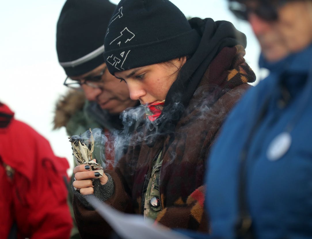
INDIGENOUS REPARATIONS COHORT WITH DR. KELLY SHERMAN-CONROY
Native Theologian Dr. Kelly Sherman-Conroy (Oglala Lakota) invites folx to join her in walking the path of reparations with Indigenous Peoples. She believes that reparations are more than just education and awareness. They are about taking concrete steps to undo the harm that has been done and to build relationships of trust and solidarity with Indigenous Peoples.
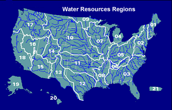
The United States Geological Survey enables folx to discover their local watershed via the map (at left).
Click on the Map to View a Particular Region
•Try the new Watershed Finder Menu Interface
 What is my watershed address and how will it help me find USGS data? (or What is a Hydrologic Unit?)
In the United States, watersheds have been numbered since the 1970's using an 8-digit system known as a Hydrologic Unit Code (HUC). This system provides what is essentially a watershed address, and in many cases provides a convenient way to locate USGS water data for your area of interest. In addition to a number, a formal name is also assigned to each HUC, but it is important to be aware that formal names can sometimes differ from a name used locally. For example, Hydrologic Unit number 02080206 is named the Lower James, for the downstream part of the James River watershed in Virginia. The first 2-digits of the code indicate that the Hydrologic Unit is part of the Mid Atlantic Region, as shown on the map below.
USGS Water Data for the Nation can be searched using either the 2-digit HUC or the 8-digit HUC for regional and local perspectives.

